

- January 7, 2020
- Posted by: Web Team
- Category: Uncategorized
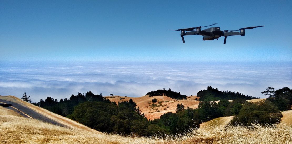
Photo by Ian Usher on Unsplash
Part 1: Desirability
Aerial is my code name for an image analysis service or business which uses a machine learning module for object recognition and detection on images that are taken from a very low altitude perhaps from a drone. The business of Aerial would be a consultancy of some sort that explores customer needs, creates a media pipeline, probably trains a neural network for custom object detection, does the actual object recognition, and creates reports and visualisations for the client.
Assessing a technology opportunity
There are many ways to assess a technology opportunity. In this and the next three articles I do an assessment on whether I could (or should) build a business using machine learning to analyse aerial images or sensory data.
The simple (first pass) assessment model I am using here – is a commonly used model, often used in reference to Design Thinking. Its made up of three elements, which are: i) desirability – the needs are we meeting, ii) feasibility – how easy is it to do and iii) viability, whether one can make money from it. This assessment is of course framed around my context. That is what skills, infrastructure and data that I have access to.
In this process I have already zoomed in on a small subset of a technology – that is – image analysis with machine learning. That technology focus is also somewhat biased, since I usually come from the technology application angle – and I am usually trying to figure out how can I apply technologies to business needs. If I was a forest ranger or fire fighter or sheep farmer I might have started off with my needs first and then try discover how machine learning could help me. For example a farmer might want to hedge their water risk by doing a regular analysis of rainfall data, soil data, costs of water purchase, and costs of insurance (thanks Kate Burke). Compared to Aerial that particular example is obviously a completely different application of machine learning, and (in this case) its much much easier and cheaper) to implement (feasible) and easier to figure out the development costs vs the savings to the end user (viability).
Although desirability, feasibility, and viability can influence each other, given our already narrow technology focus, we are going to let desirability drive the rest of the process. Once we have discovered some needs, we can then check whether it’s feasible to address those needs, and from there we can figure out whether a business cases could be created for Aerial.
Of course one might discover something new during such a process, where we might “go backwards” and broaden the likely opportunities. For example imagine we discovered a way to integrate sound and visual data in the feasibility stage, we might then think about how this could help people, for instance tracking birds via images and their songs.
The origins of this challenge (aerial image analysis) came from conversations with a friend Ulf Schroeter. Ulf works with DroneRangeNetwork. We had a discussion on how one might analyse drone images taken over the forests of Cambodia, and bingo we have first evidence of desirability.
One of DroneRangeNetwork recent successes was to detect illegal logging using the images from one of their drones – which lead to local (Cambodian) authorities taking action. In the future they wish to be able to track rare animals, but they are concerned about the scalability of having to manually eyeball every image.
Having discovered that initial need, how could we broaden our search for opportunities? That is, assuming we could classify or track things that we (or our potential clients) have captured via drone imagery – who else might need this service? We could also take into consideration that the images might not only be in the visible spectrum, but also in the infrared for humidity and heat analysis (thanks to Cairos Augusto for his input here).
I have come up with a bunch of sectors in which I think image analysis could be useful. Where possible, I have had some brief conversations with people in that field.
Conservation & Land management
Primarily government and non for profit organisations might want to analysis images to help with conservation and land management. We already have some insight here from my conversations with Ulf and DroneRangeNetwork mentioned above.
What might they want to do?
Obviously given the current disastrous bush fires happening here in Australia, this sector could include prediction and detection of fires.
In addition to detecting and tracking fires we might want to:
- Detect log cutting
- Detect camp fires or smoke
- Detect vehicles
- Detect people
- Detect & Classify fauna and flora (rare or otherwise)
- Counting stock / fauna
- Counting people
- Animal trails/tracks, single track, dirt roads
- Detect water courses, including dry water courses
- Detect Human and animal tracks
- Detect Tyre tracks
Of course just because there is a need doesn’t mean that the need can be assuaged. For example in Australia where I live, depending on the state you might not be able to legally fly drones over national parks, where much of the land management needs to happen. Without drone access (or a balloon with cameras) you might still be able take images from higher points in the landscape – however it is likely that you are still going to need a custom set of sensory data (images, infrared whatever) to feed into the machine learner, which would likely need to come from a broad range of viewpoints. This set of images, most feasibly, would come from drones.
Ag
I spoke with Kate Burke, who is an expert in Ag consulting at Think Agri.
There are many needs that private farmers have for which we could apply machine learning and in particular image analysis. We also have fewer restrictions over private land, and many farmers already own and use drones. As Kate says, they generally love gadgets and will often jump onto any new technology that might be able help them.
Livestock counting and livestock location is the obvious need. However that sort of service needs to be on demand or almost realtime, which complicates the acquisition of media and the delivering of that (high resolution) media to the machine learning service.
Vegetation analysis is also important but aerial images of trees and grass cover can probably be “eyeballed” by the farmer themselves quick and cheaply once they have the images.
Another common need is to determine soil health, for example nitrogen levels. Although there are some techniques like laser analysis of plants that can give you some understanding of soil health, soil surface characteristics are often wildly different once you go deeper (thanks Stani Ulitzka at Two Theta). Most surface techniques (laser, x-rays etc) suffer with this issue. The only reliable way to really analyse soil is to do a proper soil depth sample and take it back to the lab to analyse (which usually involves burning the sample).
I’m sure there are lots of potential opportunities in Ag, for example weather, insect, locust, dust, fire warnings, but those opportunities as out of scope for this project. In general a much more individual analysis and individual assessment is likely to be required to determine desirability, reducing the savings and feasibility of machine learning aerial image analysis – unless its an off the shelf and automatised service.
Search, rescue, health & public safety
This sector does intersect a bit with the conservation&land management sector – but its more about protecting the immediate health of people and so does require a bit more of a real time analysis than the other sectors. Here are some potential use cases in this sector.
- As above, bush fires (but not tracking camp fires of poachers, for example)
- Assessing and detecting smoke and dust.
- Tracking sharks. This is already been done on the east coast of Australia in the northern rivers region, I saw them testing a year or so ago.
- Measuring wave height.
- Ski field surveillance (eg search and rescue / anomalies).
- Beach surveillance (eg search and rescue / anomalies).
- Detect contamination through spills eg over land or marine (leakage and/or accidents from ships)
- Pinpoint flooded or blocked roads, fords, bridges, land
- Map flood zones
- Map heat zones
- Detect blocked roads
An example of a service in this sector popped up in the Sydney Morning Herald recently which describes a program called Smart Beaches. Smart Beaches “uses sensors and closed-circuit TV cameras, powered by artificial intelligence, to count crowds in the water and on the sands, and inside and outside the flags. “ (https://www.smh.com.au/national/lifeguards-to-trial-new-technology-to-help-patrol-busy-beaches-20191007-p52y6d.html)
Infrastructure
In this sector we might want to:
- Analyse congestion.
- Analyse train tracks – the state of disrepair, predict repair requirements.
- Assess/detect road quality – the state of disrepair, predict repair requirements.
- Assess general infrastructure for maintenance reasons
- Canals
- Bridges
- Irrigation
- Sewerage/Storm water
Concluding
I’m sure these needs, and their relevance to a machine learning analysis, are just the tip of the iceberg. Having discerned some needs however, if we are creating a business or a product/service for a business we still need to figure out how feasible aerial analysis is, by looking at what technology we can use, and how viable such a product or business can be, given the required machine learning needs and software architectural needs. Will people or organisations pay an amount to solve their issues which is enough to support a business?